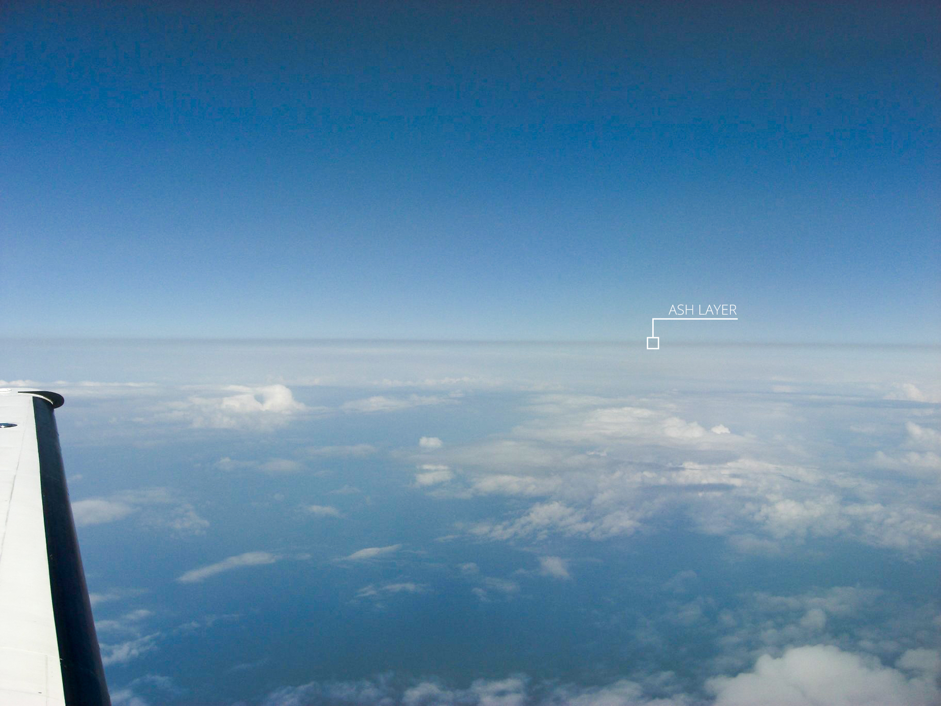
The flight made by the Cessna Citation on Sunday evening over the southern provinces of the Netherlands showed that the ash cloud is visually clearly visible. The boundaries of the ash cloud that hung over the southern provinces last night are clearly visible. This is of great importance to pilots when the airspace is partially reopened.
The reason for the flight was to verify the models used by the Royal Netherlands Meteorological Institute (KNMI) to calculate the movements of volcanic ash clouds. These measurements are used by Dutch aviation authorities in decision-making regarding the closure and reopening of airspace.
The flight made yesterday showed that the location of the volcanic dust layer was in good agreement with the models. To achieve this, the laboratory aircraft flew over the ash cloud. The ash cloud was present up to an altitude of 3 kilometres and had a varying thickness.
In Europe, there are still limited means to measure and track volcanic ash with great precision. There is also no regulation that determines at what concentration of ash particles the airspace should be opened or closed. Researchers at the NLR are therefore working closely with other institutions such as the KNMI, RIVM, Ministry of Defence, IVW, and Eurocontrol to investigate how sensors and measuring instruments can be quickly and safely deployed to accurately track volcanic ash.


