Small and silent drones for mission landing zone reconnaissance
Selecting a good landing zone in an uninhabited area requires a good and extensive exploration of the terrain by specialists. This is a time-consuming activity that sometimes has to be done in silence. Possible locations are identified using digital maps and satellite data, but that data can be outdated and is usually not very detailed. That is why an initial check of the location is needed with current, up-to-date and more accurate recordings. ‘Pathfinders’ are sent ahead by parachute to explore the area with small drones that fit in a backpack, in addition to their survival gear and weapons. In the Mission Landing Zones (MILZ) project, the partner CGI developed software that can automatically identify possible landing zones based on operational criteria and data from maps and satellites. A quick on-site reconnaissance of the possible landing zone is preferred for updating and refining the data
The Challenge
The reconnaissance must be carried out not only quickly and silently but also with a high degree of accuracy. Good sensors let a drone achieve the required accuracy. The drone has to have a large flight radius. The specialists land by parachute; the drone has to be carried in a backpack and must therefore be small and lightweight. These are challenging requirements. Can ditches and pits in the terrain be detected by a sensor in a small and silent drone?
The Solution
Taking several overlapping sets of pictures from the drone allows height differences in the terrain to be determined. The software that identified the possible landing zones can perform a new analysis based on the height differences derived from the pictures. The pictures also show the current situation on the ground. Overlap is required both along the flight direction and crosswise to it, necessitating numerous overlapping tracks over the area. This requires a small, silent and energy-efficient drone with a suitable and accurate sensor with specific software
What did we do?
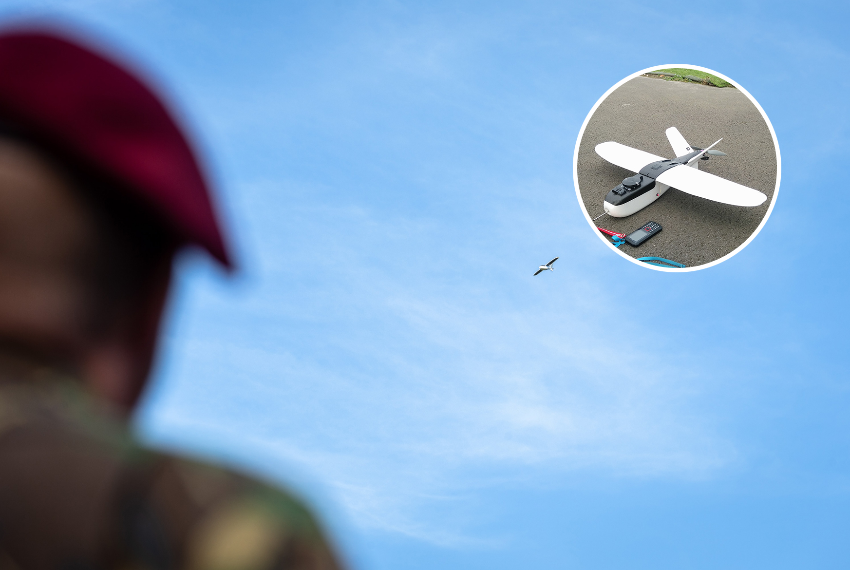
In this feasibility study, NLR analysed the client’s operational requirements and the software requirements for achieving the accuracy needed, resulting in a set of requirements for an operational drone and sensor. Using this set of requirements, a selection was made for the drone demonstrator. The assignment was not to design a new operational drone but to investigate its feasibility, focusing on (a) selecting a sensor with the required accuracy, the overlap in photos and (b) investigating if the sensor can be installed in a quiet and lightweight drone that fits in a backpack.
A cheap and commercially available fuselage with wings was fitted with a motor, propeller and flight controller. An existing sensor has been selected and fitted; additional preview software allows the overlap to be determined immediately after the drone’s reconnaissance flight.
Project partners
Government: Ministry of Defence
Industry: CGI
Research organisations: Royal NLR
Read more
