The first recordings from the Sentinel 2A satellite of The Netherlands were recently made available in the archive of ESA, the European Space Agency. This freely accessible data provides extra information about the coming agricultural growing season.
Optimum growth
Data from the Sentinel 2A is freely available. Every user – including NLR — can gain access to this open data. NLR uses this data for the Smart Farming project. By using this information about the state of agricultural crops, farmers are able to grow their crops optimally.
10-meter detail
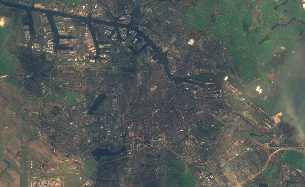
Sentinel 2A is an Earth observation satellite that detects in the electromagnetic spectrum’s visible segment and in the near and mid infrared. The satellite subdivides this range of the spectrum into 13 spectral bands, of which four bands have a resolution of 10 meters, six bands a resolution of 20 meters, and three bands are of 60 metres. With one pass the Sentinel 2A captures a detailed, 290 km wide swath of the Earth, which for the first time allows the entire country to be recorded at once and down to a 10-metre level of detail. On 23 December 2015, a recording was made of the Netherlands, in which the image of Amsterdam (see image above) appeared in natural colours.
Time series
The Sentinel 2A’s multiple spectral bands create new opportunities for providing information (big data) about agriculture, land monitoring, security and emergency management. Moreover, because some bands (purposefully) correspond with predecessors, such as the Landsat and SPOT satellites, it is also possible to create time series using recordings from multiple satellites.
Colour combinations
Sentinel 2A also offers new bands, particularly a number of narrow bands in the near and mid infrared, which present new opportunities for the more accurate detection of various types of vegetation (natural vegetation, agricultural crops) and of the growth process of crops. Various colour combinations can be created using the 13 spectral bands, whereby a large amount of information may be visualized: see, for example, the image below of the S2A recording of the area of Schoorl and Warmenhuizen, North Holland, recorded on 23 December, 2015.


