
 ACCEPTA: ACCelerating EGNOS adoPTion in Aviation
The National Aerospace Laboratory (NLR) of the Netherlands recently used its Cessna Citation II research aircraft to perform for the first time a new approach and landing procedure at Eelde airport in the north-east of the country. For this purpose NLR used EGNOS, the European counterpart of the US Wide Area Augmentation system (WAAS), which improves GPS accuracy and reliability.
Landing by means of satellite navigation is safer, because if existing ground systems (ILS) cannot be used due to maintenance, a pilot’s landing can still be guided vertically. The same applies to runways for which the installation of ILS is too expensive. With satellite navigation it is also possible to make curved approaches to divert the flight path around residential areas. Satellite navigation makes landing procedures more efficient because lower approach minimums are possible due to vertical guidance. It means that even in poor visibility (up to Cat I) an aircraft can still land.
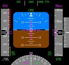
Major airports like Amsterdam Schiphol use the Instrument Landing System (ILS) to enable (automatic) landing in the event of very poor visibility. ILS is a radio navigation system that provides the pilot with an accurate view of the aircraft’s horizontal and vertical position relative to the ideal approach path to a runway. At smaller airports that do not have ILS or when ILS is not working because of maintenance or a  failure, pilots rely on radio beacon guidance which do not offer vertical guidance.
The Netherlands is not yet using an approach procedure with vertical guidance (APV) provided by satellite navigation. Some European countries have already implemented the procedure at smaller airports. For this project NLR purposely selected Eelde Airport Groningen (an airport of national importance) because it accommodates several flight academies and in the near future approaches of this kind will become a standard. It gives tomorrow’s pilots an opportunity to gain experience with GNSS-aided approach procedures.
Aircraft equipped with suitable equipment can use this approach procedure. The ACCEPTA project is using EGNOS because without signal enhancement the US GPS system is insufficiently accurate and reliable for vertically-guided approach procedures.
 ACCEPTA is being financed partly by the European Union (FP7) but is co-financed largely by the Ministry of Infrastructure and the Environment of the Netherlands. The ministry attaches great importance to approach proceduresby means of satellite navigation as set out in the PBN (Performance Based Navigation) Roadmap of the the Kingdom of the Netherlands to adopt the PBN resolution of the International Civil Aviation Organization (ICAO).
* Accidents that occurred without vertical guidance include:
1. Asiana Airlines flight 214 (Boeing 777) at San Francisco on 6 July 2013; see http://en.wikipedia.org/wiki/Asiana_Airlines_Flight_214
2. Polish Air Force Tu-154 crash near the city of Smolensk, Russia, on 10 April 2010.
Polish President Lech Kaczyński was one of the victims.
Crashes of this kind are referred to as CFIT accidents. The abbreviation stands for Controlled Flight Into Terrain. They occur when an aircraft under pilot control is unintentionally flown into the ground, an obstacle or the water. Pilots are often unaware of the danger of a CFIT until it is too late to avoid the crash.

