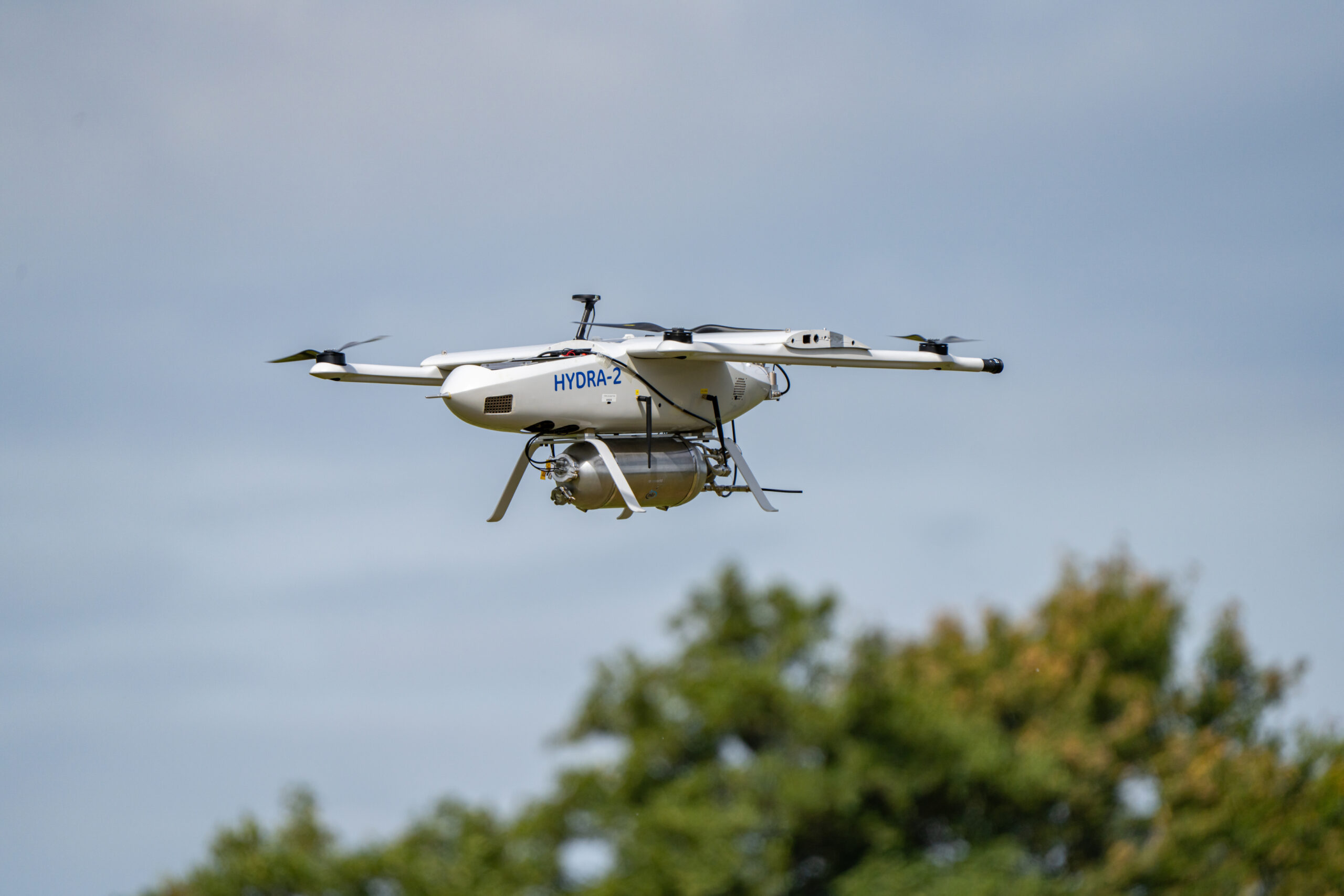
Most people know ANWB for its roadside assistance service or trauma helicopters that respond to serious medical emergencies. Since last year, ANWB has been conducting trials, regularly flying a drone between Isala hospitals in Zwolle and Meppel. The drone transports items such as medicines, blood samples, and diagnostic samples.
The ANWB Medical Drones initiative aims to make healthcare more accessible and available across the Netherlands. The idea behind this is that air transport is faster than road transport. Drones are not affected by traffic congestion. For Isala, a hospital organisation with five locations, a reliable drone connection would be a good way to centralise certain support services.
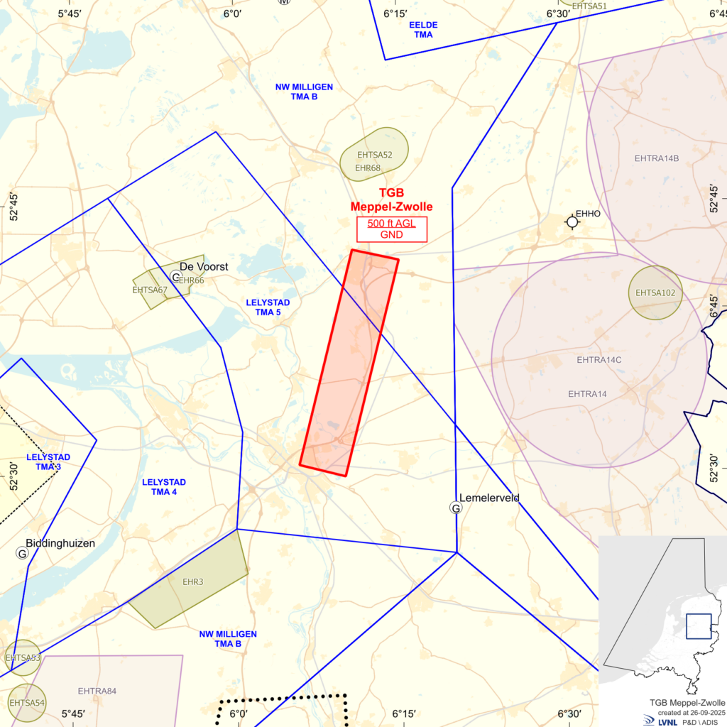
ANWB Medical Drones has been working on drones since 2019. The route between Zwolle and Meppel has been designated as a trial area since September 2025. The Ministry of Infrastructure and Water Management has established a specific zone (see the image further down the page) where civil air traffic is not permitted to fly below an altitude of 500 feet (approximately 150 metres). Exceptions are made for police, fire services, and trauma helicopters.
The drone flies regularly between the two Isala locations, and so far, it has completed around 800 flights, transporting blood samples, insulin injections, and medicines. “We were interested in several things beforehand,” says Jonas Heller, a member of the ANWB drone team. “We wanted to know if a blood sample would remain intact during transport and if the transported goods could withstand vibrations. We also looked at practical things, such as whether the payload is the right size and weight for the drone.”
A drone flight is prepared by hospital staff. Once a drone takes off, it is monitored by an operator at ANWB’s headquarters in The Hague. Previous research has shown that a drone pilot on site is not necessary. The drone typically flies its route automatically, but the operator can intervene if necessary, Heller says. “We can make the drone turn back or land quickly at a suitable alternative location. If the situation is more urgent, we can make the drone land immediately, but then we have less control over the landing site. And in the unlikely event that something goes seriously wrong, there is a parachute on board to bring the drone safely to the ground.”
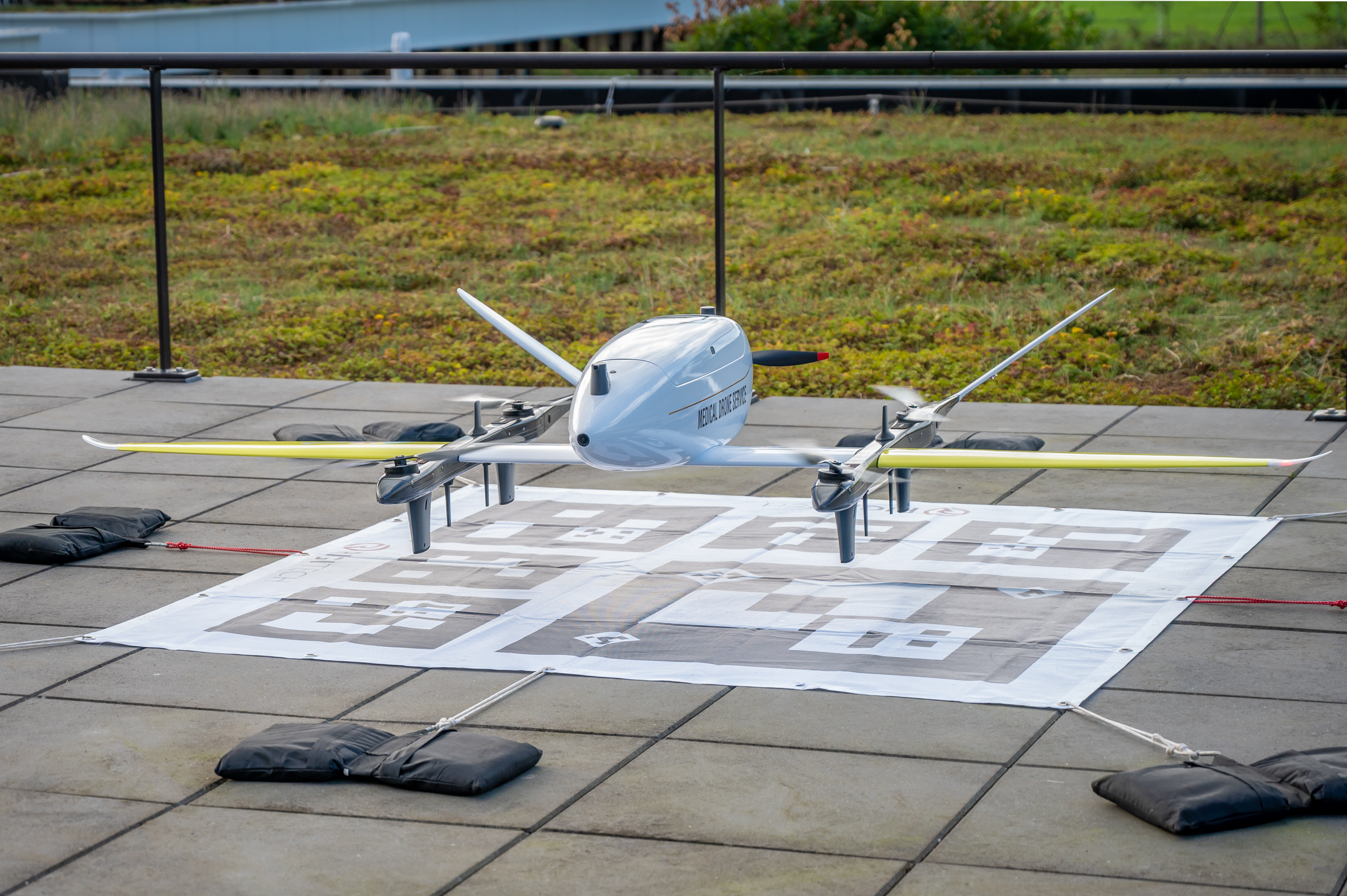
The drone used in the project is an Eiger 3 from manufacturer RigiTech. It is 2.7 metres wide, weighs 18 kg, and can carry up to 3 kg. The drone takes off vertically and then transitions to horizontal flight, flying at an altitude of 100 metres with an average speed of 100 km/h. Its maximum range, assuming a fully charged battery, is approximately 100 km. The distance between the two hospitals is about 20 km.
FlightCatcher
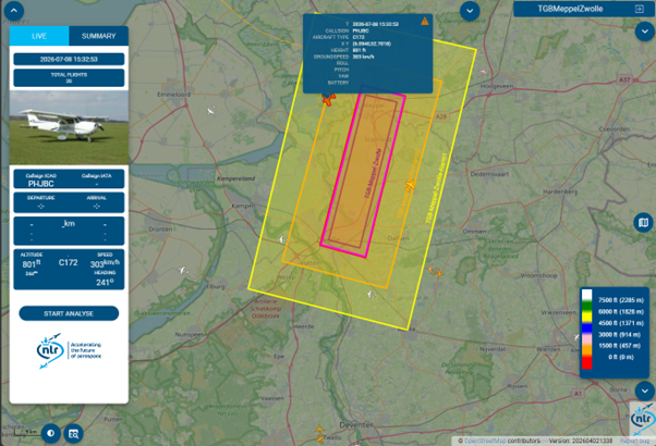
The operator at ANWB has multiple screens in front of them. One displays the software from the drone manufacturer, while a second screen runs FlightCatcher, software developed by the Royal Netherlands Aerospace Centre (NLR). The FlightCatcher programme displays all aircraft flying over the Netherlands at that moment. The data comes from tracking data provided by LVNL (Dutch Air Traffic Control), a partner in the drone project with ANWB and Isala.
LVNL not only brings expertise to the project but also wants to learn from it. “It is an interesting use case,” says Yorick van Amstel from LVNL. Coordinated drone flights – unmanned aircraft – in the same airspace where manned aircraft also operate is a relatively new concept. In the future, it is expected that many more drones will be flying around.
In the Netherlands, the rule is that drones are always subordinate to other air traffic, Van Amstel says. “That means the drone must always give way. When flying beyond visual line of sight, the drone needs ‘eyes’ to avoid things such as hot air balloons.” That is where the need for a reliable warning system like FlightCatcher comes from.
FlightCatcher monitors the airspace around the drone. If an unannounced aircraft, such as a police helicopter, Defence aircraft, or a trauma helicopter enters the corridor, the ANWB operator receives an immediate alert. “There are several zones around the drone corridor,” explains Johan Weggemans from NLR, who was closely involved in the development of FlightCatcher. The outer zone provides an early warning when, for example, a police helicopter approaches. Each time it enters a smaller zone, the warning becomes more urgent.
Over FlightCatcher
Nowadays it is perfectly common to be able look up the progress of a particular flight or identify the plane that has just flown overhead. All you need to do is visit a website such as Flightradar24. Less well-known is that as early as 2005, NLR developed a similar system for the German air traffic control agency DFS. Thanks to NLR, DFS was the first in Europe to make flight traffic accessible to the public in this way (the service still exists today!).
When building the FlightCatcher tool for ANWB, the developers were able to use software previously developed by NLR, the Flight Track and Aircraft Noise Monitoring System, FANOMOS. FlightCatcher – a tool intended for both real-time visualisation and alerting – is simply accessible via a web browser, but does not have all the capabilities of FANOMOS.
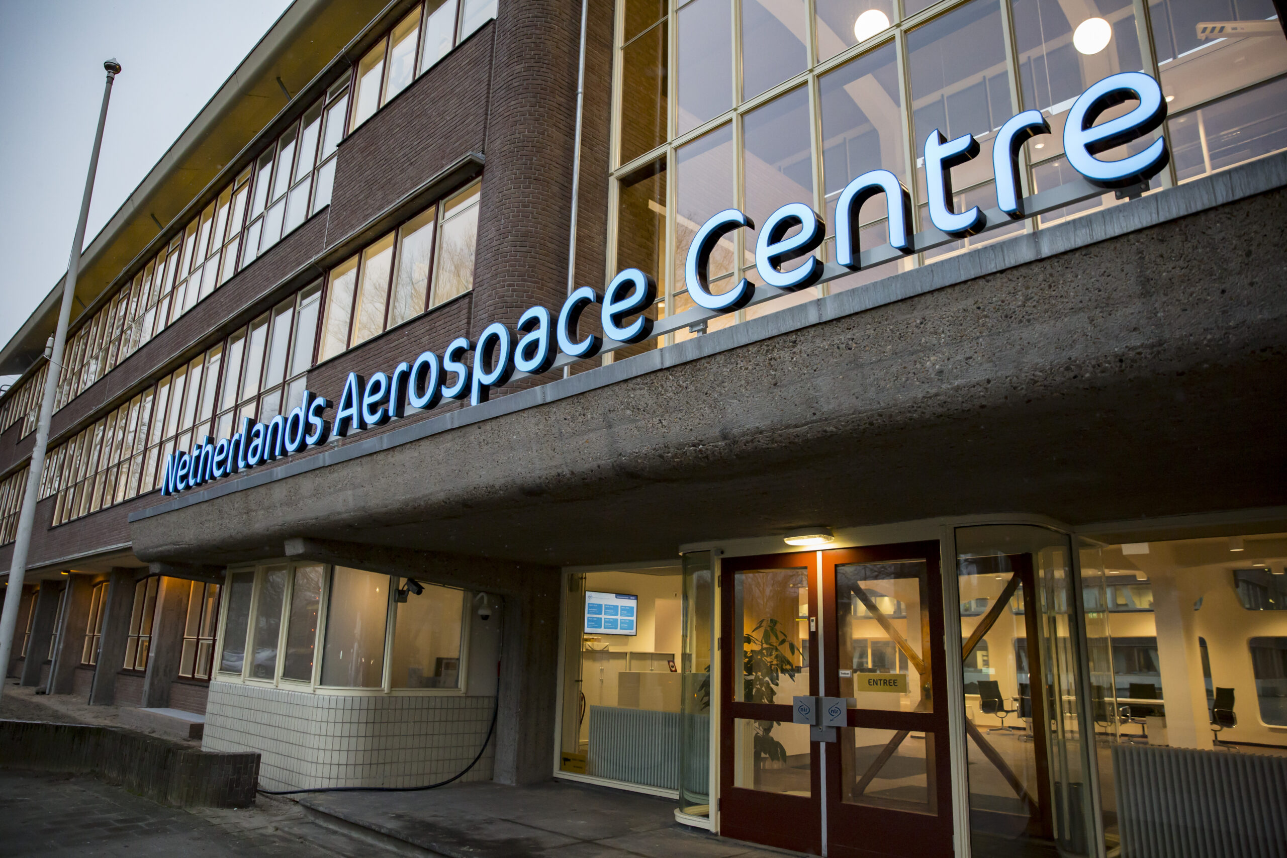
As part of the drone project with ANWB, NLR delivered FlightCatcher in early 2026. Since then, the drone operator at ANWB has had an additional screen to monitor the specially designated corridor between Zwolle and Meppel. On the screens, it looks fairly simple, but behind the scenes, a lot is happening to combine the available data. For example, displaying the location of ANWB’s drone requires location data from the drone to be continuously sent to the NLR server, where FANOMOS runs. The drone’s actual flight path is created there and then displayed in FlightCatcher. And, of course, the most important function: continuously monitoring whether another aircraft is approaching the airspace temporarily assigned to ANWB. It ultimately looks simple, but many steps are required to make it happen.
For more information about FlightCatcher: info@nlr.nl
With the help of NLR’s FlightCatcher, among other things, ANWB can fly its drone safely. “It is quite unique that we routinely fly beyond visual line of sight, so without the operator seeing the drone,” Heller says. “But thanks to the supporting systems in place, it actually becomes fairly straightforward, even a bit tedious for the operator. Virtually nothing goes wrong.” In those eight hundred flights, hardly anything has happened. It has only been necessary to intervene manually a few times.
Pilot phase extended
The initial phase of the ANWB, LVNL, and NLR pilot will draw to a close at the beginning of September. However, the trial period will be extended until mid-2027. The knowledge and experience gained will be used for follow-up steps towards a nationwide medical drone network. This will enable care institutions throughout the Netherlands to use a fast, reliable, and safe drone connection for medical logistics in the future, according to ANWB.